Season 3 Bonus: A Road Trip to the Mississippi Headwaters
In this special bonus episode, John and his daughter Lilly take a road trip from the mouth of the Mississippi River to the headwaters to get to know this great river, along with some of the people who live along its waters. From a fisherman in Plaquemines to visitors at the headwaters, each person they meet along the journey paints a picture of how they experience life by the Mississippi.
Listen now
Listen as John and Lilly meet:
Captain Mark, a fisherman in Plaquemines
Debbie, a store manager in Chatham, MS
Jonah, a bartender in Memphis, TN
Lisa Schulte Moore (from episode X) in Iowa
Taylor, a 6-year-old at the Mississippi headwaters
Jody and Rachel at the Headwaters

Show Notes
The ByWater Institute at Tulane University
John says Louisiana has lost around 1900 square miles of land in the last century — like losing the entire state of Delaware. Learn more about the amount of Louisiana land loss here.
Listen to Episode 8, where Tor Törnqvist explains that the coastline of Louisiana could be at Baton Rouge by the year 2100.
Learn more about the history of the Mississippi levees from the Corps of Engineers.
John discusses the Mississippi river’s importance to the economy. Read about the economic impact of the lower Mississippi.
Learn more about the STRIPS Project (Science-based Trials of Rowcrops Integrated with Prairie Strips).
Listen to Lisa Schulte Moore on episode 1 of Season 3 and learn more about nitrogen and phosphorus in farming and runoff.
Read more about how farming in Iowa impacts Louisiana and the Mississippi river basin.
Learn more about the headwaters of the Mississippi at Lake Itasca.
Transcript
START (AUDACIOUS WATER SEASON 3 BONUS)
JOHN: Welcome to Audacious Water, the podcast about how to create a world of water abundance for everyone. I'm John Sabo, with a special bonus episode for you.
[BACKGROUND SOUND]
I've been obsessed with rivers my whole life. I had science-fair projects that were on rivers, I watched almost every documentary I could find on water and fish, read every article I could read, I even tried to put trout in my aquarium. My dad and I used to go fishing on the South Platte River almost every weekend. South Platte's a tributary to the Mississippi at the headwaters in the Rockies of Colorado. In addition to fishing I learned how to wade across a river in the right way, diagonally, and importantly upstream so that you don't get swept away. I learned quickly and at an early age that rivers might not look powerful, but they really are; they're just discreet about it. So it's really not a surprise that I grew up to become an ecologist, doing multidisciplinary research in the area of water, and focused on rivers. After college I went to the University of Washington and then UC Berkeley, where I studied the ecology of western rivers. These rivers were really different from the ones I grew up on, but it wasn't until I got to the Mississippi River, as the director of the ByWater Institute at Tulane University, that I realized how wildly different rivers can be. My job at the ByWater Institute is to fill the enormous gap in research for climate-adaptation in the Mississippi River basin, so I really needed to get to know this great river that touches 32 U.S. states. And not only the river itself, but the people who live next to it.
[MUSIC]
And so that's how I ended up on a road trip with my daughter Lilly. I decided the best way to see this river was to take a road trip from the mouth here in south Louisiana, all the way to the headwaters in Minnesota. So with that plan Lilly and I hopped in a car and headed north out of New Orleans to the headwaters of the river in Minnesota. Along the way we stopped in Plaquemines Parish to see Mark, a fishing buddy of mine, and a man who knows a lot about the bayous, and therefore the Mississippi River.
LILLY: How long have you lived in the Bayou?
JOHN: That's my 14-year-old daughter Lilly. We wanted to meet people all along the river and Lilly was the one doing most of the talking.
MARK: Oh, better part of 50 years.
JOHN: And that's Captain Mark. We were out on his boat doing a little bit of fishing, and took this opportunity to talk to him about the river.
LILLY: What have you seen change in the environment since you moved here?
MARK: The hurricanes, and specifically Katrina, Isaac, and Rita have devastated the marsh. The marsh is wasting away at a rapid pace. There's a lot of land missing. It's not like it used to be years ago.
JOHN: Mark's exactly right. Louisiana has lost 1900 square miles of land in the last century. It's hard to put that into perspective but I'll try with this. Delaware is just around 1900 square miles, so Louisiana has lost enough land mass to equal the entire State of Delaware. And while it's been a gradual process it's not been slow. And the tropical storms that are increasing in intensity with warming temperatures continue to gobble up more and more of the coastline every year. The shape of Louisiana as we know it will be radically different between now and the year 2100, and that's not that far away. If you remember in episode 8 of this past season, Tor Törnqvist told us that by then the coastline could be as far north as Baton Rouge. I'm not going to be alive to see that, but Lilly might be. Of course being Lilly she asked how all of this was affecting the animals.
LILLY: Are the animals affected by it, too?
MARK: To a certain extent. You know, when you get a storm tide like we had for Rita we lost a lot of four-legged animals--deer, rabbits, and stuff like that, because they drowned, the tide came up so high. So it had an effect on them. As far as the fishery is concerned, it took a while for the fishery to come back. A lot of the water especially for Ida went over the protection levees, flooded the highway all the way to the river levee, and the fish got isolated on the wrong side of the protection levee. So when they pumped everything out all the fish died. We lost a lot of fish. It took probably, oh, a good seven to eight months before the fishery came back anywhere remotely close to what it was before Ida.
JOHN: Mark's livelihood is protecting this pond, his waterhole within the bayou. The hurricane almost destroyed it. We left Captain Mark and headed further south along Highway 1, to where the land meets the ocean in Venice, Louisiana. This is an appropriate name if you think about it. Here's the crazy eerie thing--the road literally goes straight into the ocean, thanks to sea-level rise. We got out of the car and looked around, watched a heron stand on the road and fish in the ocean. If Lilly didn't have a concept of sea-level rise before, she sure does now. We spent the rest of the day driving north again, leaving the bayou delta, where people are constantly interacting with these underwater forests, these bayous--fishing, boating, and literally living on the water. And we landed eventually in Vicksburg, Mississippi for the night. Vicksburg is where the Mississippi Delta begins, and the water's walled off from the rest of the world by enormous levees.
[MUSIC]
Then we got up the next morning, got back in the car, turned on some blues--mostly BB King, Robert Johnson, and Muddy Waters--delta blues, because that's the music of this region, inspired in part by the Delta itself. And we headed for Memphis. We would spend the day traveling the entirety of the Mississippi Delta on tiny backcountry roads, zigzagging around, trying to find the river; that was our goal. But we mostly got lost. And that's how we found ourselves at Roy's store in Chatham, Mississippi, lost and hungry, looking for snacks. If the goal was to meet locals and ask about the river, by the looks of this place we'd found the right spot. It was a Sunday and the parking lot was full of trucks, all there, it seems, for the fried fish. But if they were so inclined they could also get gas at Roy's store and any fishing gear they might need there, too. We ventured inside and then we met (Debbie), the store manager, and we got to talking with her. It was at this point when we started to notice that the people in the Mississippi Delta don't interact with the water in the same way the people do in the bayou delta. Just listen to what happens when Lilly asked (Debbie) about her experience with the river over the years and how she's seen it change.
(DEBBY): Whoo, you make that tough on me there, girl.
JOHN: "You make that tough on me, girl." It took her a while to think about it; eventually she answered the question.
(DEBBY): Well, you know, there's been a lot of changes. When the river went down there was a lot of changes. (Kind of a) lot of washes. There's a lot of more people fishing on that river for catfish and stuff. The traffic on it for the barges, they have picked up. You know, it slowed down a little bit when the water got down. But that's really - there's not a whole lot of changes on it except, you know, it does still have a flow and it's still (washin') on the sides and stuff.
JOHN: As a side note, one thing I found interesting about what (Debby) was saying was that she called floods "washes." I'd never heard that term before. In Arizona "washes" are dry river channels. Everything Debbie was saying was fascinating to me as a scientist getting to know this great river, and how the people around it perceive it. But here's the part that I found the most interesting.
LILLY: Does the river affect your daily life? Does it play a part in your life?
(DEBBY): No, it does not.
JOHN: It's so interesting to me because it's symbolic of the separation that the levees create between the river and land. It does affect your daily life, and here's why. In the big picture the river fuels commerce, helping shuffle goods all over the planet. But more relevant to (Debby)'s daily life is that Roy's store is a fishing-tackle shop, providing for the Oxbow Lakes, which at one point in time were part of the river. People come here to fish, boat, and camp, and probably stop at Roy's store. The levee keeps agriculture from getting washed away by floods. The catfish they serve is surely from the Oxbow Lakes. (Debby) mentioned all of this when Lilly asked about the changes she's noticed. It's just so easy to forget that these impact daily life when the river is hidden from your view.
JOHN: Does it flood here?
(DEBBY): No, not here. They've got the levee built now so it don't flood like it used to. The only problem now is the one down at the Yazoo Rover. That's the one that gets up and it floods pretty bad. And it goes into Eagle Lake when the river comes up. It affects them real bad. Did you see the sign that says "finish the (pumps)?"
JOHN: Yeah.
(DEBBY): That's what that's about. They want the pumps finished so they can pump that water when it starts flooding.
JOHN: The Mississippi Delta has two levees, one that keeps the Mississippi from going over-bank, and one for local tributaries like the Yazoo River. Levees have been crucial for stabilizing agriculture in the Mississippi Delta and for providing protection from flooding for one of the poorest regions in the U.S. But the way that they're engineered is inflexible, given climate change. The levees basically create this big bathtub, much like the levees in New Orleans. When there's lots of rain in the Delta the rainwater gets trapped in there by the levees. It fills the bathtub. It floods. It's engineered that way. It's by design. The intention is that the water gets pumped out, but that doesn't always happen. With more rainfall due to climate change this can happen more and more often. So what (Debby)'s talking about isn't so much the rivers over-banking, it's the landscape, thanks to the levees holding the water in. The levee system has been engineered to be constant.
(DEBBY): Mississippi River is a mysterious river though.
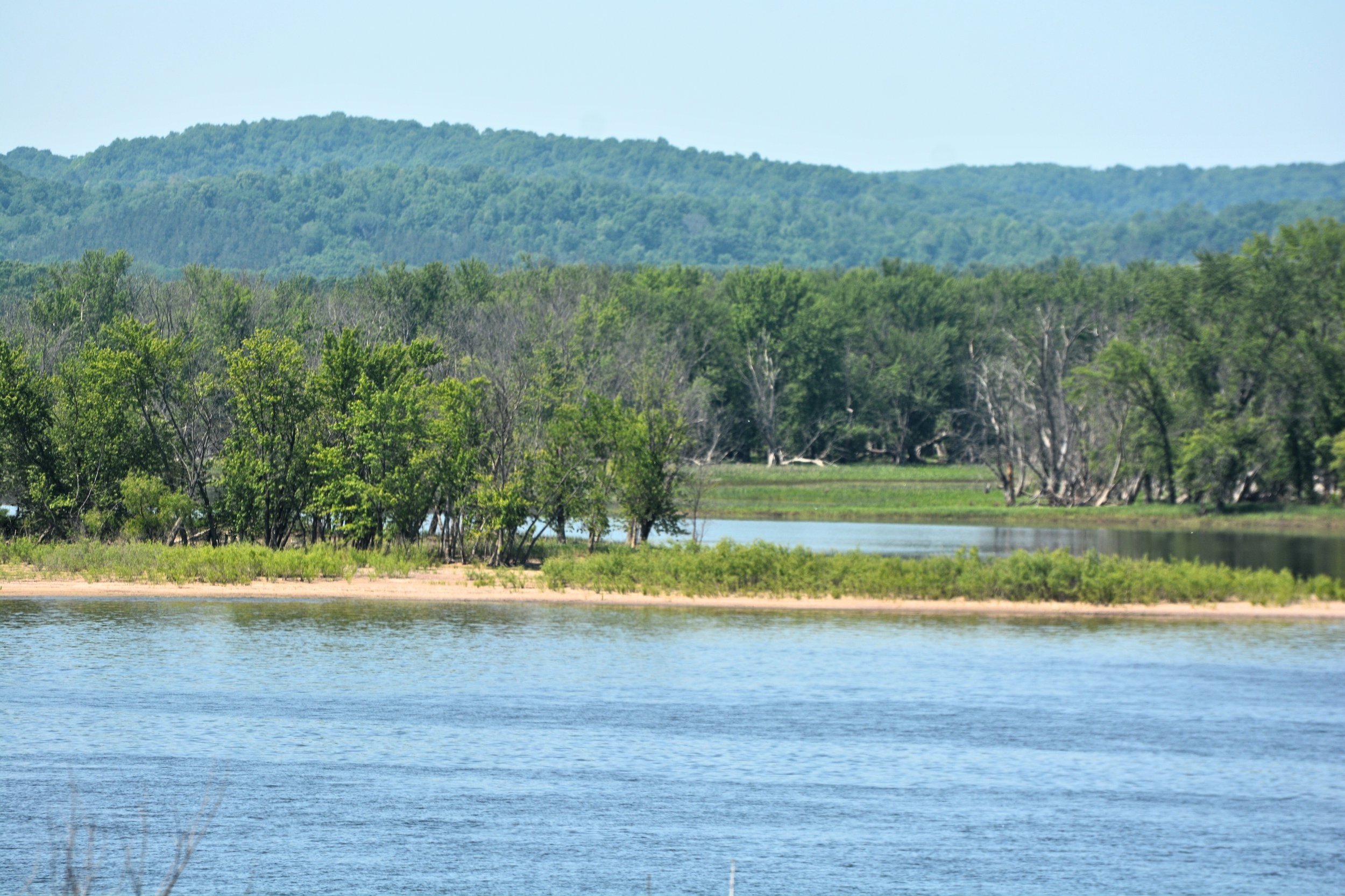
JOHN: It is indeed a mysterious river. Before we started engineering it by adding levees the river moved to new places all over the Delta. Now thanks to us it doesn't do that anymore. And another thing that affects this section of the Delta is that we've engineered the Yazoo and the Mississippi as if they're independent; and of course they're not. One is a tributary of the other and they both shape, or used to shape, that landscape. We left (Debby) and went in search of the river, which it turns out wasn't a simple task. We spent most of the day just trying to find places to look at it. At one point we had to drive up a really steep levee before we could finally see it. We even ventured over the bridge into Arkansas just to see the river before coming back and heading north to Memphis. By this time we'd been driving along the river for two days, and we made three stops--one to fish in the bayou delta, one to see where the land meets the ocean, and one to grab snacks at Roy's store in the Mississippi Delta. Two things were becoming abundantly clear from our road trip along the water. First, there's a lot, and I mean a lot of court growing around the Mississippi. I expected to see swampland, maybe people playing music on the corner; what we actually saw was farmland and lots of levees. But mostly we just saw corn. And second, the levees were so high you hardly ever see the river. You just can't see the Mississippi River and most of the Mississippi Delta. I'm not really sure if many people along the Mississippi realize the irony of living along the Mighty Mississippi yet hardly ever seeing its waters. In fact, it seemed to be a foregone conclusion that you'd have to go somewhere high to even see the river. When Lilly asked Jonah, the bartender at our Memphis hotel, where the best place to see the river would be, here was his answer.
JONAH: I would say on top of the Bass Pro pyramid, at the very top, or any of the small rooftop parties that people have on the weekends.
JOHN: You might be imagining the Bass Pro pyramid to be a few stories high. That's what we thought, too, but we were wrong. Here's how Lilly described it.
LILLY: It was this giant pyramid that looked like it was from Star Wars or something. There was, like, a restaurant, a hotel inside of it.
JOHN: This pyramid is ten or twelve stories high with hundred-foot cypress trees inside. It's not only a retail center, but like Lilly said, it had a hotel and a restaurant inside it. It dwarfed everything around it. We made it to the top of the Bass Pro pyramid, and Jonah was right, it was the best place to see the river. Lilly asked Jonah what was good about the water in Memphis, and his response was interesting. He said it's the best drinking water, thanks to the Memphis aquafer, and that it's also great for beer. He talked about how beautiful the Mississippi was, though he says it's dirty. He mentioned wakeboarding on the Mississippi, though he wouldn't recommend it, and parties on the water, like birthdays and weddings. He talked about the Memphis riverboat cruises that go up and down almost every single day. But he also talked about one of the biggest modern-day functions of the great Mississippi: commerce.
JONAH: And it's one of the - it's a very big distribution hub. You know, we've got FedEx here, and then we've got barges coming through every single day.
JOHN: One of the things Lilly and I found most interesting was how different people see the river differently.
LILLY: You said it's dirty--do you think that has changed throughout the years? Like, do you think it started off cleaner?
JONAH: I think it's probably gotten dirtier. I don't see the EPA or any big corporations doing anything (about) to change it.
JOHN: There are two sources of pollution--one is industrial that comes from the Ohio River, and the other is largely agricultural which comes from the Mississippi mainstem.
LILLY: Do you think the river is important for the economy?
JONAH: 100%. If the barges can't get through, and we start experiencing droughts, and the river goes down we could see a destructive thing to our economy.
[MUSIC]
JOHN: By this point it's day three of the trip and we've only seen the river three or maybe four times. The river is almost completely hidden from people who live right next to it. It's necessary for protection, but that protection also creates a barrier with a huge part of nature, a part of nature that literally fuels their lives. Lilly commented on this later when we were discussing the day. She brought up (Debby) from Roy's store, and how she said she didn't have a connection with the river.
LILLY: She was blocked because of the levee. And in reality she probably did have a connection with the river--her drinking water comes from it and stuff like that--but she just doesn't know it because she can't see the river.
JOHN: We left Memphis and veered off-course of the Mississippi, really on a personal mission to cross off a bucket-list item to see the burial site of Johnny Cash in Nashville. On our way back towards the Mississippi we crossed over the Tennessee and Ohio Rivers, two big tributaries to the Mississippi, probably two of the biggest water sources to the Mississippi outside of the Mississippi mainstem. We were hoping to go on a helicopter ride from downtown St. Louis to the confluence of the Missouri, the second-largest tributary to the Mississippi, and where Lewis and Clark began their western explorations. The weather was bad so we couldn't do it. Instead we drove over a bunch of bridges and went to the confluence on foot. As we stood on this enormous sandbar opposite of the Missouri River, where it joins the Mississippi, we pondered the length between this tributary of the Mississippi and the State of Louisiana, 500 miles south. This river, the Missouri, is the most significant source of sediment to the Mississippi, and therefore to rebuilding coastal Louisiana habitat. It's incredibly important to the coastal marshes and the coastal communities of the state.
[MUSIC]
We got in the car and headed north, continuing to zigzag on country roads, following the river as much as we could until we abandoned it and went west to Iowa, to see my friend Lisa (Schulte-Moore). You might remember her from episode one in this last season of Audacious Water. Along the way we stopped for lunch in Hannibal, Missouri. You can't see the river here because the levee is a mile high. We dined at a Burger King--not my first choice, but it's what was there. While we were eating I saw these three ladies having lunch and said to Lilly, "Those are people we should talk to." But by the time we got the recorder out of the car and got back inside they were gone. But here's what I think they would've said if Lilly had gotten the chance to ask them. "This community has, over the decades, suffered from enormous flooding which has damaged or destroyed our communities, and also made it much more difficult to make a living on corn. And the control of flooding by levees has really helped us stabilize economically and as a community." And I would imagine, too, we would've asked them about Huck Finn, because it's the hometown of Mark Twain, and they would've said, "This isn't the river of Mark Twain anymore." It's not a free-flowing river anymore that creates the kind of nature that you imagine when you're reading Huck Finn. It's controlled and channelized behind the levee to protect communities and farmland. We drove through what felt like endless corn fields until eventually we made it to Ames, Iowa, to Lisa and her prairie strips. I wanted to come here as part of this trip because Iowa, and more broadly the I-states--Illinois, Indiana, and Iowa--are the top sources of agricultural pollution to the Gulf that create the dead-zone, which we talked about in episode 4 with Nancy Rabalais, and Lisa is trying to fix that. Her solution is to put nature back into farmland.
LISA: So this is, you know, the prairie strip. There is definitely, you know, some of the brome grasses invading a bit. Just looking down you'll notice a lot more species diversity.
JOHN: Lisa works for Iowa State University and she and her team have been conducting research on the use of prairie strips here for a decade. STRIP stands for Science-based Trials of Row crops Integrated with Prairie strips. They've interspersed these huge rows of native prairie in specific locations of corn and soybean fields. Planting native prairie is an affordable conservation practice that actually benefits the farm, helping conserve the soil and water. We stood inside one of the prairie strips as Lisa pointed out some of the plants we were seeing.
LISA: This is called a "compass plant;" its flowers will kind of turn. And that one looks like spiderwort right here. Here's golden alexanders that's got a yellow flower a lot like the wild parsnip, but this is a good prairie plant. This is wild bergamot or horse...
JOHN: So this is a one-meter-square plot with high diversity.
LISA: Yeah - yep - yeah. Like this grass is little bluestem; it's not the brome. Here's the golden Alexanders. So, you know, it looks kind of like the other one but it's not. This is prairie comb flower - or no that ones not...
JOHN: I'm stepping on some invaluable native species here.
LISA: Yeah, that ones not - I'm not sure what that one is, but no...
JOHN: It was pretty cool to see a lush prairie in between rows and rows of monoculture. There were so many different plants everywhere, bees and insects moving around, and as Lilly noticed, lots of different birds, too.
LILLY: What's the situation with the birds and, like, what are the kind of birds that are here?
LISA: So let's see. The majority of the birds that we're hearing right now, that [MAKES BIRD SOUND] that's a dickcissel. So [MAKES BIRD SOUND] it'll say its name. There's three species that we most commonly find using prairie strips: redwing blackbirds, dickcissels, common yellowthroats--but then there's a whole host of other things, like eastern and western meadowlark, and then it just kind of dribbles into a whole bunch of other species, as well. Dickcissel, we've monitored their nest. Because they're numerous we can get really good data around their nest success. One of the concerns when we first started putting out prairie strips was among the wildlife community, like, "Are you just luring birds out here to a place where they're going to die?" because there's so much predation by things like skunks, and raccoons, and fox, and opossum and such in these locations. And so we had to actually do the studies, like, you know, can we see that there's actually a source for the population here? Is it high-quality habitat or is it what we would call a "sink," where the birds would next here but there's such high predation rates, or because exposure to weather or whatever, the nests are failing.
JOHN: Well, at least it's not a sink for those, right?
LISA: Right. Yeah, it's not like it's in an ecological trap, right, where they're being lured out here. For those species they're just not using these areas. There's just not enough habitat.
JOHN: All these birds, and really all this prairie just isn't something you see anymore. For a scientist it was amazing to see. But for farmers prairie strips can be a gamechanger as well. These native grasses grow deep roots, they take up more nitrogen, which is good for water, and they hold onto the soil--important to a farmer if he paid for that soil. Lisa and her team are particularly interested in the amount of nitrogen and phosphorous in that runoff. These fertilizers are important to farming, but they pollute the river and ultimately end up in the Gulf of Mexico.
LISA: So we're measuring, you know, how good are we at keeping the nitrogen and phosphorous where we want it to be in the cropland vs. not, you know, flowing out with the water? Because that would create a water-quality problem. And then also sediment, which is basically soil that's on the move. Again, you know, we of course want, you know, vibrant, healthy soils in our croplands, but when it gets into our waterways, another pollutant in the waterway.
JOHN: I wanted Lilly to see this because I really wanted her to understand how everything we do, even farming in Iowa, is connected via the river, the river that's 200 miles west of here, the same river that flows all the way down to New Orleans, to Venice, to where the road meets the sea.
LISA: Yeah, eventually the water ends up in the river.
JOHN: This part of the trip, letting Lilly see the connection between what we do off the river and how it affects the river all the way down, was really important to me. So before we left and headed back to the Mississippi I had to check that she understood that.
JOHN: Why is her work important for people in Louisiana, for example?
LILLY: Because the fertilizers on the farms in Iowa run off into the river, and can pollute the bayous and stuff.
JOHN: At this point I knew the trip was a success. Seeing this much of the river in such a short time is a really powerful way to see the connections between land, water, and ocean, and Lilly was getting that. It was time to head to the headwaters of the Mississippi, our final destination, Lake Itasca in Minnesota. And strangely after all this time and all this corn, once we got into Minnesota we could finally see the river, partly because the river is smaller here so the levee is less necessary. But it's also in a canyon in parts so you can see it from above. When we got to the headwaters we could see kids playing everywhere.
[BACKGROUND NOISE]
JOHN: Hey, what's your name?
CHILD: Taylor.
JOHN: Taylor? And where are you from?
CHILD: Alabama.
JOHN: Oh, you're from Alabama? We just came through Mississippi. Pretty close by. How old are you?
CHILD: Six.
JOHN: You're six years-old? That's so cool. And do you like to hang out by lakes and rivers?
CHILD: Yeah.
JOHN: How long have you been in Minnesota?
CHILD: I don't know.
WOMAN: Three days.
JOHN: I met Taylor from Alabama at the headwaters in Lake Itasca. He was there with his family. I asked him if he knew that this was the headwaters of the Mississippi and he told me yes, but I'm not sure he really did. The Mississippi River starts as a trickle of water from Lake Itasca. You can walk right across it; it's maybe 20 feet wide. It's a far cry from further south, where the river famously is a mile wide, and much more in some parts.
JOHN: Is it amazing that this is the Mississippi?
CHILD: Yes.
JOHN: And why is it so amazing?
CHILD: Because I like it.
JOHN: Uh-huh. Did you walk across the Mississippi here?
CHILD: Uh...
WOMAN: Yeah, you did.
CHILD: Yeah, I did.
JOHN: How many steps or jumps did it take you?
CHILD: Uh, so much.
JOHN: Like, it took me ten. Did it take you that many or did it take you less?
CHILD: Less.
JOHN: After hanging out with Taylor I met Jodie and Rachel from Minnesota, who were vacationing at Lake Itasca. I asked them, "How did Minnesotans engage with water?
WOMAN: It's everywhere and that's where all the fun is. You've got to find the water to have the fun.
JOHN: "That's where all the fun is." It is so much fun to be out on the water. It's what drew me to rivers in the first place as a kid. But there's so much more to the Mississippi that so many people just don't see anymore, in places along the 2350 miles of river, because we've removed ourselves from it and removed it from us.
[MUSIC]
JOHN: That brings us to the end point of this one-way journey up the Mississippi River Valley. As a child I always dreamed of doing this trip, or maybe even one like it but on the river. I imagined that I was going to see a wild river, the river of Huck Finn. But in reality we saw corn, lots and lots of corn, from Mississippi to Minnesota, corn. This is a working river, and its watershed is designed to grow, process, and ship commodities from the heartland to the rest of the world. For this reason the river itself is highly regulated. It is straightened and deepened to make commodity export efficient. It is also levied to protect farmland and large cities from the epic floods of the past. It is humankind and its commodity trade vs. the river. So one of the main takeaways for me and Lilly was that there is a separation between people and the river that runs from the headwaters to the mouth, and this separation is much more metaphysical than the infrastructure that creates it. This separation is, for sure, physical. The levees prevent even a casual glance at the water passing by, unless you try hard to climb the levees like we did. But this separation is also cultural. It is survival and consistency of life. The river is viewed by many as polluted and the source of all destruction. The further away from daily life and your home and way of life the better. A second takeaway is the corn. There are nearly 142-million acres of corn and soy in the basin. This is approximately the area of three average-sized whole states in the United States, or twice the area of the State of Colorado. This is not just a lot of commodities; it's a lot of fertilizer, much of which runs off into the river and eventually into the gulf, where it causes the zone of hypoxia. Our guest Lisa has one solution for this. But at what scale do we need to build prairie strips or other regenerative ag practices in order to make a difference? Lisa says 10% of all farmland--that's a big effort.
[MUSIC]
As we push our way down the path of climate change will all this still work? Will this tightly-managed working river still work for us to push out more and more commodity? One thing that is certain to me after this trip, the way that we view infrastructure has to change. First, nature-based solutions like prairie strips that retain nitrogen in soil, often at the benefit of the farmer, need to be implemented across the entire Mississippi River watershed. A 10% target is enormous but not unimaginable, especially given the size of projects being undertaken in Louisiana for coastal and river restoration. Second, some of our solutions will require us to think about opening up levees in strategic locations and managing floods with nature. In Louisiana we are doing this to flush sediment from the river onto the bayou to save sinking marshes. Reconnecting floodplains strategically higher in the basin could reduce flood impacts locally and simultaneously remove nutrients, and provide new sources of sediment for rebuilding coastlines.
[MUSIC]
Reconnecting with nature is not a silver bullet, it will have to be done with science to coordinate with the built infrastructure that we are locked into place with. I'm struck by what (Debby) from Roy's store in Mississippi told us. She said, "I have no connection to the river." She is certainly not alone. This is a theme Lilly and I heard all the way up the river. As climate change accelerates, reconnecting to the river both physically and culturally is important. We will never have the river of Huck Finn again, but building nature back into this heavily-managed working river is key to climate-adaptation.
[MUSIC]
[0:28:43]
END (AUDACIOUS WATER SEASON 3 BONUS)